Exercise 9b – Sharing data in AGO
Sharing data in ArcGIS Online
Intro
This instructions show more advanced aspects of ArcGIS Online (AGO). They are not needed for the purpose of this course. You need this when you have your own research and want to share your original data with others.
These instructions assume that you have completed ALL the instructions about uploading an ArcGIS project to AGO as described in ex 8 part 1 and that your map is now shared in AGO and that you can see it listed under your maps.
Understanding your content
When you uploaded your map to AGO you actually uploaded multiple objects. You can see the uploaded maps in the Content – My Content window of AGO. The image below shows you part of Eugenio’s with the police stations/Mass towns map on top (in my case they’re just called “Map”).
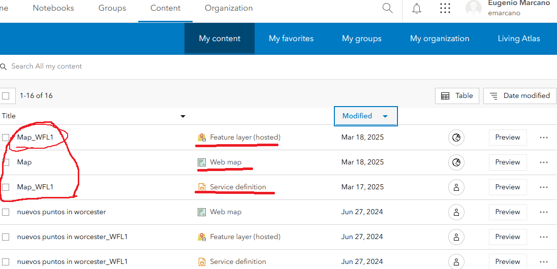
Notice that the map that I uploaded (called “Map”, not a very original title) actually created 3 different entries:
- Web map: this is the actual map that you uploaded from ArcGIS Pro. This is the one that you need to configured to be “shareable” and the one you’ll use in Storymap
- Feature layer (hosted): this is the actual data (feature classes) and the target of this document. More on this in the following section.
- Service definition: this is an internal file. We don’t need to worry about it now. Read this document from ESRI if you want to learn more.
Sharing feature classes
- Click the title (Map_WFL1) in the line of Feature layer (hosted)
- In the Overview screen of the Map_WLF1 notice that the layers that make up the map are listed. Pay attention to the different sections of this screen. If you’re planning to share the data make sure you fill out a good Summary, Description, Terms of Use, any extra comments. Explore all the different options and menus.
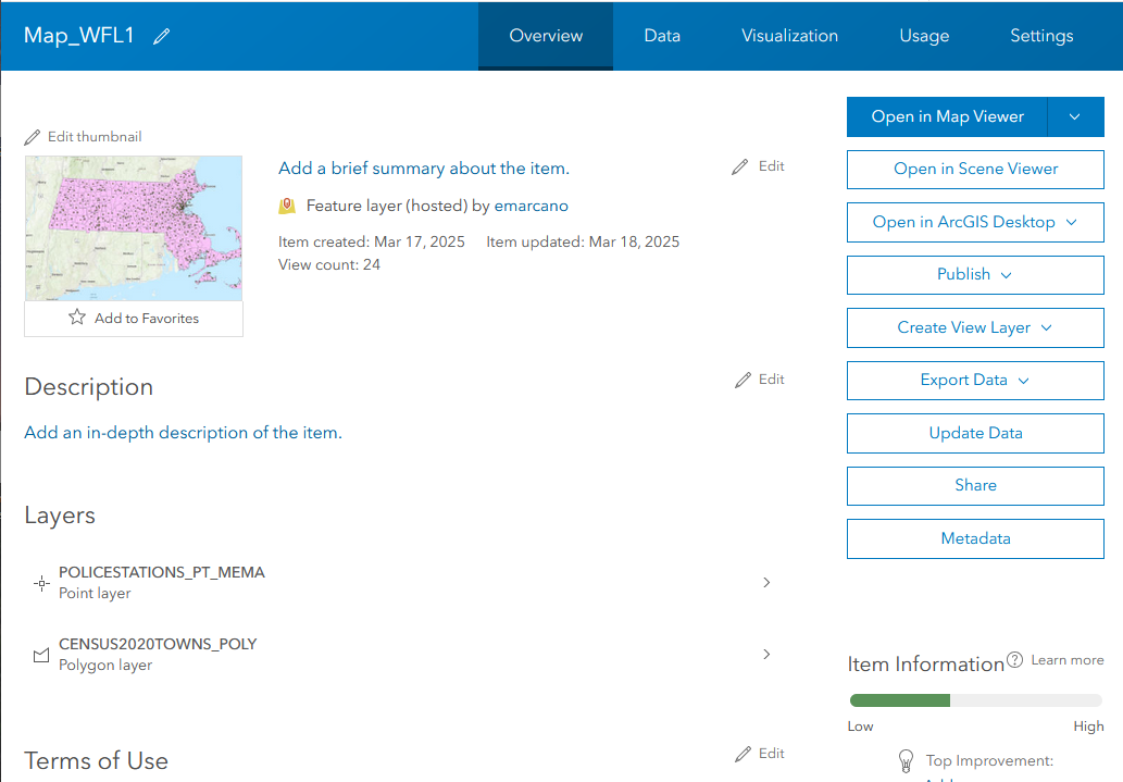
- Click on Settings in the upper right
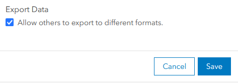
- Familiarize yourself with the different settings here, then scroll all the way to the bottom and tick the box for Export Data then Save.